Devil's Slide ***
Formerly-infamous stretch of Highway 1-now hiking trail (while cars go through new tunnel)
Top Locations:
1. Devil's Slide
2. Geology
3. WWII Fortifications
4. Pacific Ocean
Time for Visiting: 1-2 hrs
Cost: $0
Best Season: Anytime that is not Winter
Bring: Camera, windbreaker
Difficulty: Flat + : Well paved, two large hills
Scale: ***** Must Visit
**** Worth Detouring
*** If in the Area
** May be Worth Visiting-Once
* Interest only
Any local of the San Francisco Bay Area knows about Devil's Slide. For years, HWY 1 ran through here, and the area had an sinister
reputation of accidents and landslides that would close HWY1 and cut off
Pacifica to the South (locals apparently dubbed themselves "the World's
longest cul-de-sac"). However after the recent Caltrans project, the
area has been sealed off from cars, and made into a hiking trail, though
whether the area continues collapsing remains to be seen. It appears popular.
 |
| Mudstone, with stratification |
 |
| Montara Mountain Granite |
The Devil's Slide in California is a promontory with a steep, collapsing slope just South of Pacifica. Here, the Cretaceous granite of Montara Mountain pushed against the Paleocene mudstone, a mix of marine shale, sandstone and conglomerate, of the San Mateo Coast. Though the fault is now inactive, the mudstone has for decades been collapsing into the Pacific.
 |
| Devil's Slide |
Due to its dangerous geology, Devi's Slide was undeveloped until 1907, when the Ocean Shore Railroad linked San Francisco to Half Moon Bay. The company quickly found the area difficult, as landslides required frequent maintenance, and finally stopped in 1921. In 1937, HWY 1 opened here on the site of the old railroad, allowing drivers to move along most of the California coast. Within days of opening, a landslide closed the road, and since then, landslide closures, became a frequent occurrence, including in 1942, 1951, 1952, 1977, 1982, and in 1983. In 1995, a large side of the road collapsed, taking months of repair. It occurred for the last time in 2006.
The periodic collapses of HWY1 at Devil's Slide provided a headache for Caltrans, the manager of the highway system. In 1958, proposed a massive six-lane freeway going over Montara Mountain. Complete with this would be a massive development of a corridor linking San Francisco to Half Moon Bay. Caltrans waited for a disaster to allow Federal emergency funding to push through the plan. During this wait, locals, beginning to fight urban sprawl and appalled at the planned 200000 new residents in the area, and the destruction of wetlands for the endangered California Red-legged Frog, began forming local environmental movements.
 |
| New Bridge passes over Shamrock Ranch |
After local lobbying, in 1972, the California Coastal Commission put the 6-lane highway plan on hold. Caltrans responded with a very large two-lane highway. The Sierra Club and other local groups then sued Caltrans based on the new National Environmental Policy Act. Though the groups were successful, Caltrans simply put the plan on hold, hoping to push it through during emergency repairs. After intense lobbying, Caltrans revised its plans, decreasing the new road, though it continued to run through critical watersheds and cut straight across a State Park. Another lawsuit in 1986 stopped the project.
Finally, in 1995 a tunnel plan was created, through Caltrans continued to state the freeway bypass was more cost-effective. After intense local outreach, and a leaked Caltrans document suggesting that the costs of the tunnel plan were purposefully inflated, the local community in 1996 passed Measure T by 74%, forcing Caltrans to utilize the tunnel approach.
 |
| Tom Lantos Tunnels |
After Measure T passed, Caltrans changed its tune and began working on the tunnels. San Mateo Cong Tom Lantos had consistently pushed for Federal emergency funding to repair HWY1 at Devil's Slide, and with Sen Barbara Boxer helped secure Federal funding for this tunnel project. In 2007 the boring began, which completed in 2013. The new tunnels, named after Congressman Tom Lantos, are 9m in diameter and 1265 m long Northbound (right) and 1222 m long Southbound (left), the second, and third longest tunnels in California.
The Devil's Slide Trail opened on March 27, 2014 as one of the newest trails in California. It is 2km long and goes through Devil's Slide over two high but undulating hills.
 |
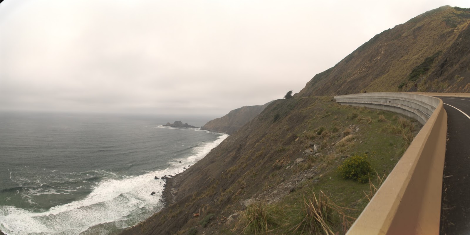
| San Pedro Rock is visible in the background |
There are amazing views of the Pacific, of Devil's Slide itself, and of old military bases. Some interpretive signs are present.
Here, viewing the WWII-Era Fire Control Station which contains bunkers, pillboxes and a steel observation post, the sheer instability of Devil's Slide is visible.
During WWII, Devil's Slide and Little Devil's Slide Military Reservations were set up, as at so many locations around the California coast, allowing visual triangulation of enemy ship and aircraft locations. They have been abandoned since then.
Known locally as the Stairs, this forward fire control station would originally have been located firmly on cliffslide. However heavy erosion around the bunker has now left it hanging tenuously alone. Sooner or later, it will collapse.
To reach Devil's Slide from San Francisco, Take HWY 1 to Pacifica. After passing the Linda Mar District (with a Safeway and Denny's to the left), the road will begin to ascend. Right before you come to a bridge, a small flashing light shows a pullout to a road on the right (the former HWY1). Turn and park. If you miss the turn (or find the parking lot is full), continue through the tunnels, and take the first right to another small parking lot, or just a little further, left to a large parking lot for McNee Ranch State Park. The parking lots are often crowded and if you're unlucky you may need to park alongside HWY 1 and continue to the trail by walking along the curb.
https://www.google.com/maps/dir//37.5853267,-122.509998/@37.5789159,-122.5128304,15z/data=!4m3!4m2!1m0!1m0?hl=en


No comments:
Post a Comment